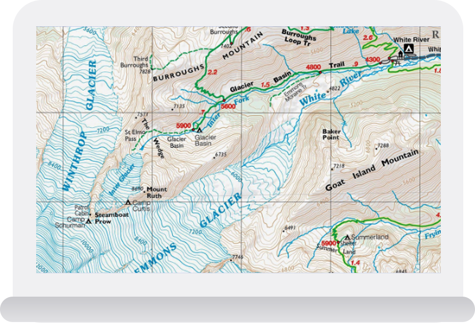
A topographic map shows how the ground is shaped and provides a way to calculate the
height of the features on the map.
Contours are generated from digital elevation models (DEM)
DEM’s represent the 3D terrain in point cloud format generated from LiDAR or through a combination of points and break lines collected from aerial imagery
Data density is chosen according to the complexity of the terrain
Planimetric features are surface features which have been extracted in 3D from aerial photography
All visible features such as roads, rooftops, vegetation, rivers, lakes, etc. are traced into a 3D vector file
Industries
We deliver meaningful and lasting results for our clients.